Historic Landscape
Characterisation
The Gwent Levels
01 Nash/Goldcliff coastal
zone
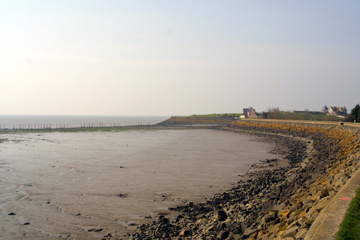
01 Nash/Goldcliff coastal zone character area: complex "irregular landscape" in higher coastal area, with small irregular fields, sinuous lanes and dispersed settlement. (Photo: GGAT Gwent Levels 033)
Click here for a character area map
The higher coastal parts of this landscape were certainly reclaimed by the late eleventh/early twelfth century when Goldcliff and Nash were granted to Goldcliff Priory. Lower-lying areas inland were enclosed and drained by the thirteenth/fourteenth century.
Subsequent changes in landuse, population increase leading to the proliferation of scattered farms and cottages, and the enclosure of commons and roadside waste, have meant that this has been a constantly modified landscape, but one that in essence is high medieval in date.
An abundance of prehistoric intertidal archaeology is known off Nash and Goldcliff, and this is likely to extend inland under the later alluvium. Evidence of Roman occupation was found when the Nash sludge pits were dug, during construction of the Uskmouth Power Station and around Goldcliff Point. A Roman inscription, the "Goldcliff Stone", records the work of legionaries on a linear earthwork, presumably a sea wall.
A wide range of documentary material exists for this area, including a series of charters for Goldcliff Priory, and thirteenth century accounts of how the drainage system worked. Locally, there are strong cultural associations with the Priory; farmers widely attribute the reclamation of this area to the monks.
Key historic landscape characteristics
Diverse landscape: abundant intertidal and buried archaeological remains,
drainage features (reens, banks, grips, surface drainage, bridges) small
irregularly shaped fields, sinuous lanes with roadside waste, dispersed
settlement, and large commons, monastic associations
Area of relatively high coastal land, bounded by be Severn to the south; Uskmouth industrial development to the west; Newport urban/industrial areas, the Llanwern Steel Works and intermediate landscapes (area 2) to the north; Whitson (area 3) and Porton (area 4) to the east.
This was, and still is, a common type of complex and diverse landscape, typical of the higher coastal parts of the levels. It is characterised by small irregularly shaped fields, sinuous lanes with roadside waste, dispersed settlement and large commons. This wide range of well-articulated landscape elements gives it a high group value.
There are strong associations with the Priory on Goldcliff Point, of which Monksditch is the most obvious aspect. Though still in use, this is of great historical significance. The areas of landscape north of Goldcliff Point, and around Chapel Lane, Clifton Common and Saltmarsh are particularly well preserved. Several areas have suffered damage from agricultural improvement, but in other areas, preservation is excellent.
The visually most positive feature of this landscape is its diversity. The northern and western areas are over-shadowed by Uskmouth, Newport and Llanwern, but towards the coast, the area is quiet and secluded. There is a great diversity of features and good preservation of earthworks demonstrating the complex drainage hierarchy.
Hedge management varies considerably. There is a mixture of scrubby and cut hedges with some isolated mature trees; areas south of the Nash-Goldcliff road tend to have more scrubby hedges.
Generally this is a fairly intensively used landscape with significant areas of arable, especially in south-east Nash.
Overall this landscape has a reasonable integrity (though many of the roads are metalled and there are many modern cottages), and a reasonable coherence (being predominantly a working agricultural landscape).
This is a very diverse landscape, reflecting its long history of formation, with an irregular field-boundary pattern and sinuous lanes. Much of the once ample roadside waste has been enclosed, though traces survive (eg Saltmarsh Lane). North of Goldcliff Point, Mireland Pill forms one side of a particularly fine green lane, there were several linear street commons; most have been enclosed (eg Broadstreet), though the Clifton example survives.
The settlement pattern was mainly dispersed with farms and cottages scattered throughout the landscape. Several earthwork complexes represent the sites of abandoned settlements, including the scheduled moated site by Chapel Lane in Goldcliff. Nash and Goldcliff villages now largely consist of modern buildings, though there are a number of fine old farmhouses elsewhere.
Several NRA and IDB reens flow through this area, though historically few are of particular significance; most follow natural meandering courses. The exception is the raised watercourse of Monksditch, which carries water from an upland stream to the coast, preventing this fresh water from flooding the Levels. It is first documented in the thirteenth century and was probably constructed by the monks at Goldcliff.
There are a wide range of other landscape features, such as a fine collection
of bridges over Mireland Pill. The sea wall is rubble faced having been
rebuilt quite recently. The survival of grips is patchy, but fine examples
occur to the north of Red House Farm, either side of Chapel Road. Clifton
Common and Saltmarsh Lane (all in Goldcliff) and around Tatton (Nash:
allocated for development). Pollarded willows are fairly common towards
the coast, particularly to the south of the Nash-Goldcliff road. The remains
of the last working putcher rank in Wales stands off Goldcliff Point.